 |
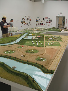
| Roman Operating System: from Mutations, OMA |
After our initial introduction to the rivers and its systems today, and as we move into the long weekend, here are the landscape categories for each team (of 2) to dive into:
•levees, river training structures, wharves, access points
•wetlands, conservation areas, open space, physical geography
•industrial land use, agricultural practices
•urban patterns, residential types, ex-urban developments
•the river itself, broader regional influences, watersheds, etc
We will be working toward a
Users-Guide to The American Bottom; so historical, contemporary, and proposed data will all be helpful in forming the background information for the handbook.
For Wednesday, each group should come with the following deliverables at minimum (all 11x17):
•site plan diagram explaining current conditions
•site plan diagram charting changes/phases over history
•sectional diagrams explaining how elements/types/systems work within theme
•single, cropped aerial image of a moment that best illustrates tensions/intentions of your theme
•expository axonometric diagram of the same spot chosen for aerial
The diagrams should be drawn with an eye toward legibility--so things like line-weight, color, fill, text, etc, as well as what is included and what is excluded from the drawing, should all be selected accordingly and intentionally. We will talk about both the information as well as about how it is displayed. In addition, print out all pertinent documents that contribute to your analysis and bind together for reference throughout the semester.


